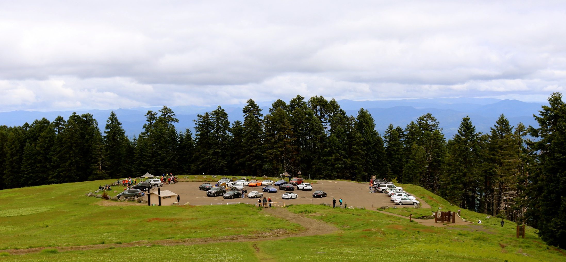
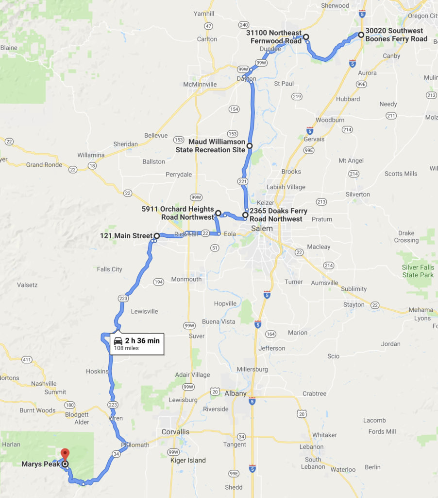
Start at the Boones Ferry Road in Wilsonville heading west to Dayton, turn south towards Salem. Shortly before Salem turn wets again and head to Dallas, turn south again to Philomath, where we turn on Hwy 34 until we meet the intersection of the Marys Peak Road. From there, entertaining turns and grades up to Marys Peak.
Oregon Region is marching through the year at a steady pace. March turned out 11 events, which may be a record for this time of year. Even though it is still early, we have seen a couple of new events on our calendar including the new dining event, Road and Fork, and an out-of-town tech session in Tacoma. I was thrilled at the number of new faces attending the New Member Orientation. Be sure to check out stories about each of those later in this edition. I realize now one of the key elements of having so many events on the calendar is maintaining momentum while not over- burdening our volunteers. The processes and procedures are ever- evolving, and while much of it is becoming routine, keeping all the balls in the air at once is challenging. The Drive Team and the Social Committee have been working overtime, and it shows. If you see any of the drive team or social committee members out and about, be sure give them a thumbs up and a smile – they deserve it! This year ORPCA is celebrating 65 years and PCA is turning 70! The cars, the people, the clubs have a lot to celebrate. Back in 1955 and 1960, there were no 911s, no 914s, 944s, Boxsters, Caymans, Cayennes, Macans, Panameras or Taycans and very few variations on the models that did exist. There were a handful of regional clubs and not many members. Today there are 148 regions under the national umbrella with over 160,000 members participating in over 4,000 events every year. In the area of Club history and how PCA and Porsche have evolved in 70 years, there are two great things every Porsche owner should check out if you haven’t already. One is the fantastic history of Porsche Club of America found on the PCA website: https://ww2.pca.org/pca- history (login to PCA.org, drop down the “Membership” tab to “PCA History” near the bottom.) This is a long read, but worth it. The other entertaining and education place to spend some time is PCA’s YouTube Channel: If you have not visited the PCA YouTube Channel, be forewarned, it is an addictive spot. https://www.youtube.com/@ PorscheClubofAmerica/featured With nine more months of this exacting year ahead, I trust I will bump into many of you more than once and that alone makes it worthwhile. As you know, it’s not just the cars, it’s the people. Let’s Drive! You can reach me at [email protected].